🇹🇭 Kanchanaburi, Thailand · Thong Pha Phum National Park
Khao Chang Phueak
เขาช้างเผือก
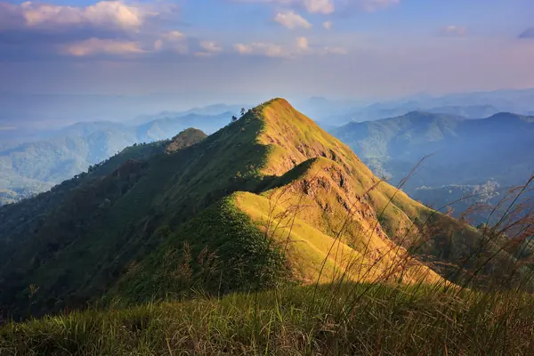
Photo: Khunkay · CC BY-SA 3.0
Difficulty: Moderate
About this place
A peak famous for its knife-edge ridge, with sheer drops on both sides. The trail climbs through bamboo and evergreen forest before you stand on the summit above the sea of mist over the Vajiralongkorn Dam reservoir.
Highlights
- The knife-edge ridge on the summit
- Sea of mist over the western forests
- Camping deep in evergreen forest
Day by day
- Day 1: 8 km · about 6–8 hrs on foot — Campsite on Khao Chang Phueak
- Day 2: 8 km · about 4–7 hrs on foot — Summit and knife-edge ridge, then hike back down to Ban E-Tong
Distance = the ascent from Ban E-Tong; most people spend a night at Ban E-Tong before the hike. Day 2 covers the same distance as day 1 and takes 1–2 hours less, since the descent is always faster.
Before you go
Open in the cool season only, limited to 60 people a day. Book online through the Google Form in the park's announcement (for 2026/27, registration for the first round, hiking 1–15 Nov 2026, opened on 16 Oct 2026 at 10:00; the Google Form link is posted on the Thong Pha Phum National Park page, so watch it for later rounds; last year it was one person per booking). It's a long nature trail of about 8 km from the forest at Ban E-Tong, Pilok subdistrict, done as 2 days and 1 night with about 4–6 hours of hiking a day. The knife-edge ridge is narrow and exposed. Sample Thai tours cost about 2,390 THB (meeting at Ban E-Tong) to 3,690 THB (by van from Bangkok).
Do you need a guide? A local guide or porter is required
Contact the park
Thong Pha Phum National Park
Sources
Nearby places
- Khao San Nok WuaKanchanaburi, Thailand · 50 km away
- Lam Khlong Ngu CavesKanchanaburi, Thailand · 60 km away
- Huai Mae Khamin WaterfallKanchanaburi, Thailand · 65 km away
- Erawan Falls (7 tiers)Kanchanaburi, Thailand · 91 km away