🇹🇭 Trang, Phatthalung, Thailand · Khao Banthat Wildlife Sanctuary
Khao Chet Yot (Banthat Range)
เขาเจ็ดยอด
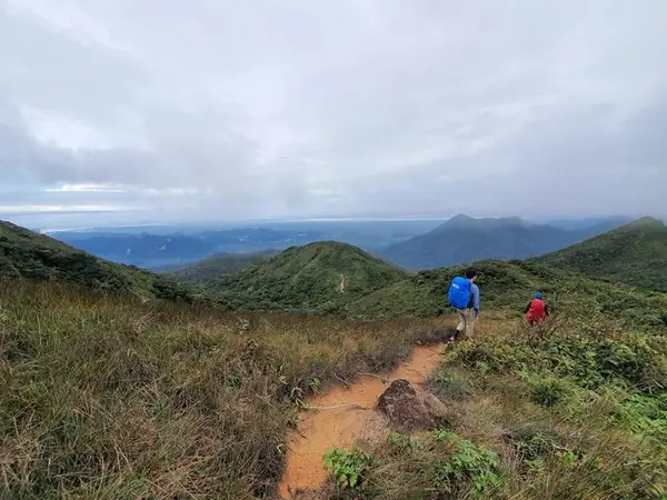
Photo: Khow Puttaraksa · All rights reserved. Do not use without permission.
Difficulty: Hard
About this place
A peak of about 1,200 m in the middle of the Banthat Range, with rainforest full of moss, ferns, wild orchids and streamside waterfalls. On a clear day the summit looks out over both the Andaman Sea and the Gulf of Thailand. It is a multi-day mountain crossing, sleeping and eating in the forest.
Highlights
- Views of both the Andaman Sea and the Gulf of Thailand from the summit
- Rainforest, moss, ferns and wild orchids
- A Phatthalung–Trang crossing ending at Nan Sato Waterfall
Day by day
- Day 1: 10 km — Riverside camp (Phatthalung side)
- Day 2: 8 km · about 6–7 hrs on foot — Khao Chet Yot camp and viewpoint
- Day 3: No distance info — Down to Nan Sato Waterfall on the Trang side
Total distance over 25 km according to Thairath.
Before you go
In Khao Banthat Wildlife Sanctuary, on the ridge between Phatthalung and Trang. You must get permission from the sanctuary before every hike and be led by a ranger or local hunter-guide; don't split off or walk ahead of the guide. The popular route goes up from the Phatthalung side and down to the Trang side (there is also an up-and-back option from one side). The total distance is over 25 km according to Thairath. Some groups take 4 days, 3 nights. According to tour programmes, day 1 is about 10 km past streams to a riverside camp; day 2 is about 8 km and 6–7 hrs of steep trail to the Khao Chet Yot camp; on the last day you walk down to Nan Sato Waterfall on the Trang side. Tour prices depend on the organiser and starting point and don't include porters for personal gear or tent rental. There are no toilets along the way and mobile signal only in some spots. Cautions: lots of leeches, heavy rain, thick mist and slippery mud; continuously steep trail where you climb roots, scale rock faces and use ropes; the path is unclear and unsigned, so there is a risk of getting lost; the ridge near the summit is narrow and windy. Not suitable for beginners who haven't done an overnight hike before.
Do you need a guide? A local guide or porter is required
Sources
Nearby places
- Ton Nga Chang WaterfallSongkhla, Thailand · 59 km away
- Sa Morakot (Emerald Pool)Krabi, Thailand · 93 km away
- Wang Hip (Khlong Wang Hip trek)Nakhon Si Thammarat, Thailand · 109 km away
- Khao MenNakhon Si Thammarat, Thailand · 110 km away