🇹🇭 Lampang, Thailand · Wat Thung San, Ban Kho Subdistrict (Buddhist mountaintop sanctuary)
Doi Jik Jong Khong Kham
ดอยจิกจ้องฆ้องคำ
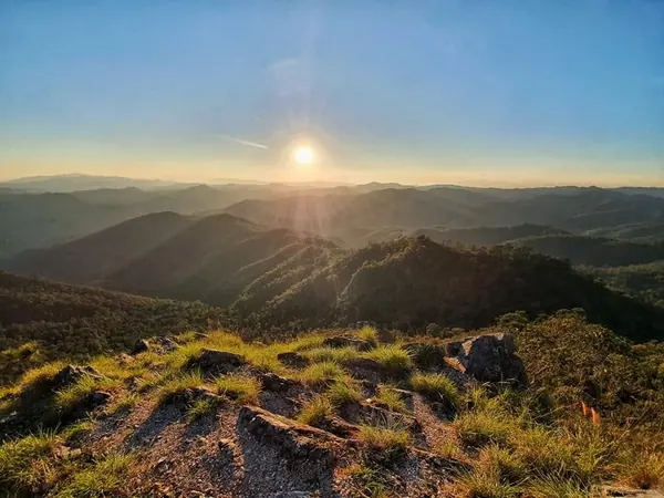
Photo: Khow Puttaraksa · All rights reserved. Do not use without permission.
Difficulty: Moderate
About this place
A Buddhist sanctuary on a mountaintop in Mueang Pan District, Lampang, with a chedi, a pavilion and a camping area on the summit. The 4.5–5 km climb alternates steep and flat stretches, passing a rest pavilion and water tanks, and rewards you with about 180-degree views over Mueang Pan at dawn and dusk — ideal for one night on top.
Highlights
- 180-degree views over Mueang Pan
- Buddhist sanctuary and chedi on the summit
- Camping area for sunrise and sunset
Start from the foot of the mountain (about 3 km from Wat Thung San according to Pantip), climb to the summit and return the same way. There is a pavilion and water tanks midway.
Before you go
Doi Jik Jong Khong Kham is a mountaintop Buddhist site looked after by Wat Thung San, Ban Kho Subdistrict, Mueang Pan District, Lampang, about 60 km from Lampang town (about a 1-hour drive according to Pantip). You must register before climbing at the village headman's house, Moo 1, near Wat Thung San, and let the temple know in advance (see the reference articles for contact details; no private numbers are listed here). No official entry fee was found; reviews say entry is free with donations at the donation box. Other costs according to reviews: Readme.me lists parking at 100 THB, the shuttle to the trailhead at 40 THB and a 100 THB per person rubbish deposit; Trip.com lists the shuttle from the temple to the trailhead at 100 THB per vehicle; Lemon8 says parking at the small field is 50 THB a day (these figures don't match, so check with the village headman first). The access road is gravel and needs a pickup or high-clearance vehicle. The walk from the foot of the mountain to the summit is about 4.5–5 km and steep throughout (one review says steep all the way, another rates it easy for people who have hiked before). No guide is needed; the trail has signs and ribbons, but there are several junctions, so take care. There are rainwater tanks along the way and on the summit, but many reviewers say the water isn't clean, so bring a filter or your own water. On top there is a pavilion, kitchen, toilets and camping area; no electricity and patchy phone signal, so bring a head torch. It is a sacred site: carry your rubbish down and keep quiet. The cool season is very cold. Pantip says the area is within Chae Son National Park, according to the writer (not confirmed).
Do you need a guide? You can hike on your own
Sources
Nearby places
- Wat Chaloem Phra Kiat Phrachomklao Rachanusorn (Wat Phra Bat Pu Pha Daeng)Lampang, Thailand · 10 km away
- Doi Nang Mao (Doi Nang Mo)Chiang Mai, Thailand · 20 km away
- Doi Khun TanLamphun, Lampang, Thailand · 30 km away
- Doi Langka LuangChiang Rai, Lampang, Phayao, Thailand · 31 km away