🇹🇭 Chiang Mai, Thailand · Doi Suthep–Pui National Park
Doi Suthep: Pha Lat Trail (Monk's Trail)
ดอยสุเทพ เส้นวัดผาลาด (Monk's Trail)
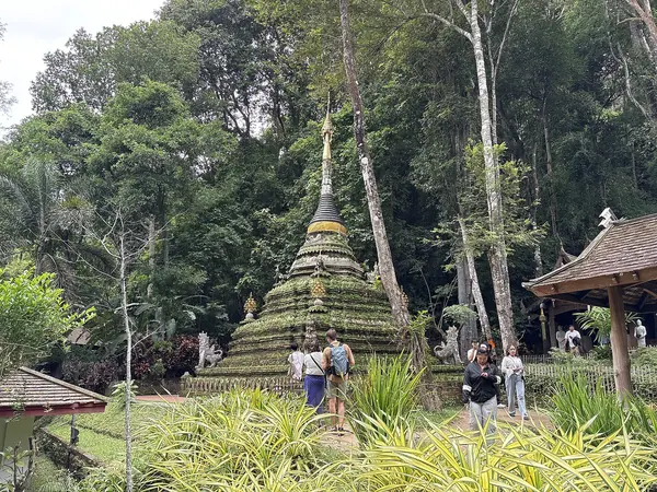
Photo: Chainwit. · CC BY 4.0
Difficulty: EasyDay trip
About this place
The hiking trail closest to Chiang Mai city. It climbs through dry dipterocarp forest to Wat Pha Lat, a forest temple with a stream flowing over rock terraces, and you can carry on up to Wat Phra That Doi Suthep. It's both a hiking trail and the city's trail-running training ground.
Highlights
- Wat Pha Lat in the forest
- Views over Chiang Mai along the way
- Half a day there and back from the city
Pha Lat nature trail, uphill one way, about 2 km, 2 hrs.
Before you go
You can walk it on your own. The entrance is behind Chiang Mai University (CMU) at the end of Suthep Road (the Basecamp Trail Hub café is a popular starting point). The Wat Pha Lat nature trail is about 2 km one way, takes about 2 hrs and runs from 440 to 615 m. From behind CMU to Wat Pha Lat and back is about 4 km; if you continue up to Wat Phra That Doi Suthep, the round trip is about 10 km, steep at the start and at the end, coming out at the Khun Kan bend. You can take a red songthaew back down from in front of Wat Phra That. Wat Pha Lat has no official opening hours and charges no entry fee (by road); the start of the Monk's Trail may ask for a small maintenance fee. There are no shops or toilets along the way until the car park at the top. Watch out for slippery ground in the rainy season, and dress modestly for the temples.
Do you need a guide? You can hike on your own
Contact the park
Doi Suthep–Pui National Park
Sources
Nearby places
- Doi Pui Summit Nature TrailChiang Mai, Thailand · 6 km away
- Doi NoriChiang Mai, Thailand · 27 km away
- Doi Nang Mao (Doi Nang Mo)Chiang Mai, Thailand · 35 km away
- Moai Peak (Yot Khao Moai), PhraoChiang Mai, Thailand · 50 km away