🇻🇳 Vietnam
Ha Giang
ฮาซาง
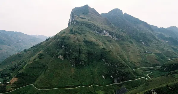
Photo: Khánh Hmoong · CC BY 2.0
Difficulty: Moderate
About this place
Vietnam's northernmost limestone mountains on the Chinese border. The popular trip is a loop over the Ma Pi Leng Pass, looking down on the Nho Que River in its deep gorge, with stops to walk through ethnic minority villages and rice terraces.
Highlights
- Ma Pi Leng Pass
- The Nho Que River in its deep gorge
- Lung Cu, the northernmost point
Day by day
- Day 1: 12–15 km · about 6–8 hrs on foot — Nam Dam (via Lung Vai, Khuoi My)
- Day 2: 5–7 km · about 3.5 hrs on foot — Dong Van (walk the Quan Ba–Dong Van section, drive the rest)
- Day 3: 8 km — Ha Giang (via Ma Pi Leng, Meo Vac)
A mix of walking and driving; distances cover the walking sections only, per the Ha Giang Trails operator's 3-day programme. The Hoang Su Phi route walks about 8–15 km/day.
Before you go
Foreigners entering the northern border districts such as Dong Van and Meo Vac need a Border Area Permit, costing about 230,000–260,000 dong (about US$8–13). You can get it through a tour company or at the immigration office in Ha Giang city; it takes about 15–30 minutes. In 2026 checks are strict, with police checkpoints, and accommodation must register guests with the police. Without a permit you may be fined 500,000–2,000,000 dong and sent back. If you ride a motorbike yourself you need a valid driving licence, according to a motorbike operator's website (not official). Buckwheat flowers bloom late Sep–Dec, peaking Oct–Nov, with the festival in mid to late Nov, according to Vietnamese tourism websites.
Sources
Nearby places
- Sapa Village TrekVietnam · 162 km away
- Mount FansipanVietnam · 172 km away
- Nong Khiaw: Pha Daeng & 100 WaterfallsLaos · 388 km away
- Nam Ha NPA, Luang NamthaLaos · 459 km away