🇹🇭 Khon Kaen, Thailand · Nam Phong National Park
Hin Chang Si Viewpoint Trail
หินช้างสี
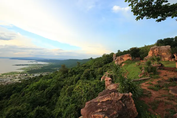
Photo: RobTob · CC BY-SA 4.0
Difficulty: EasyDay trip
DurationDay trip
Total distance0.4–1.3 km
Budget per person40–300 THB
Best time to goAll year; sunsets are best Nov–Feb
About this place
The closest national park to Khon Kaen city. You walk past strangely shaped sandstone carved by millions of years of erosion, including potholes and traces of ancient rock paintings, ending at the Pha Tawan Lap Fa terrace and viewpoint with a panoramic view of Ubol Ratana Dam.
Highlights
- Panoramic view of Ubol Ratana Dam
- Pha Tawan Lap Fa sunset viewpoint
- Strangely shaped sandstone
A short nature trail; no time given.
Before you go
A nature trail of about 1.3 km, mostly flat, with steps up to the viewpoint in places. There are toilets, a welfare shop and a car park. About 60 km from Khon Kaen city, with no public transport, so drive or hire a vehicle.
Do you need a guide? You can hike on your own
Contact the park
Nam Phong National Park Headquarters
Sources
Nearby places
- Pha Sawan Trail, Nam PhongKhon Kaen, Thailand · 2 km away
- Phu Wiang Dinosaur TrailKhon Kaen, Thailand · 26 km away
- Phu Pha Man: Bat Cave & WaterfallsKhon Kaen, Thailand · 75 km away
- Phu KraduengLoei, Thailand · 88 km away