🇹🇭 Nakhon Si Thammarat, Thailand · Khao Luang National Park
Khao Luang
เขาหลวง นครศรีธรรมราช
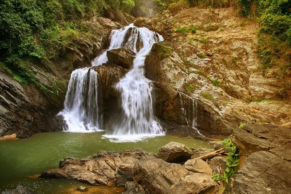
Photo: Chaiyathat · CC BY-SA 4.0
Difficulty: Hard
About this place
The highest peak in southern Thailand, with rainforest that stays green all year. Near the summit is a cloud forest of dwarf trees covered in moss, and with luck you'll see a sea of mist stretching to the Gulf of Thailand.
Highlights
- Cloud forest of moss-covered dwarf trees
- Endemic flowers on the summit
- Khiri Wong, a village known for its fresh air
Day by day
- Day 1: about 4–6 hrs on foot — Lan Sai (first night's camp) — ride a motorbike from Khiri Wong to the trailhead first
- Day 2: about 4 hrs on foot — Up to the summit of Khao Luang, then back to the same camp
- Day 3: No distance info — Walk down to the meeting point, then ride a motorbike back to Khiri Wong
The 3-day, 2-night version uses a motorbike for the first part; without the motorbike it's 4 days, 3 nights. The 26 km figure comes from a tour organiser.
Before you go
Call Khao Luang National Park between the 1st and 10th of the month before your trip to check availability. Porters are local community members whom you contact yourself. You can ride a motorbike for the first part to cut down the walking days.
Do you need a guide? A local guide or porter is required
Contact the park
Khao Luang National Park office
Sources
Nearby places
- Khao Luang: Fa Mi Peak – Noen Lom FonNakhon Si Thammarat, Thailand · 10 km away
- Khao Maha Chai, Nakhon Si ThammaratNakhon Si Thammarat, Thailand · 12 km away
- Wang Hip (Khlong Wang Hip trek)Nakhon Si Thammarat, Thailand · 22 km away
- Khao MenNakhon Si Thammarat, Thailand · 24 km away