🇹🇭 Chiang Mai, Thailand · Omkoi Wildlife Sanctuary
Doi Mon Jong
ดอยม่อนจอง
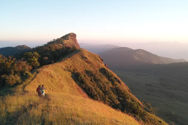
Photo: Unnawut Leepaisalsuwanna · CC BY 3.0
Difficulty: Moderate
About this place
A grassy ridge stretching out like a dragon's back, home to the rarely seen goral. The trail is steep, but the open ridge views go on the whole way.
Highlights
- Open grassy ridge as far as the eye can see
- A chance to spot goral in the wild
- Rhododendrons early in the year
Day by day
- Day 1: 4–7 km · about 2–4 hrs on foot — Doi Mon Jong campsite
- Day 2: 4–7 km · about 0.5–3 hrs on foot — Up Pha Hua Sing (1,929 m summit) for sunrise, then hike back down to Ban Huai Pu Ling
km = ascent distance to the campsite. Chillpainai says the 1,929 summit is another 2 km past the camp. Day 2 covers the same distance as day 1 and takes 1–2 hours less, since the descent is always faster.
Before you go
Booking is only through the Omkoi Wildlife Sanctuary website (wildlifesanctuaryfca16.com/omkoi); booking for the 2026/27 season opened on 4 Nov 2026 at 08:00 (wildlifesanctuaryfca16.com/omkoi/reservation). Sanctuary contact: 083 482 1983. A staff guide is always required. Arrive at the visitor centre before 12:00 on the day you climb, then take a villager's 4WD to the trailhead (there are 2 sides: Ban Musoe or Ban Huai Pu Ling). It's about 6–7 km, 3–4 hrs, to the campsite (some reviews say 4–5 km). 2 days, 1 night is recommended according to reviews. Entry 30 THB, camping 30 THB, 4WD about 3,000 THB per vehicle, porters about 40 THB per kg (some sources: 800 THB per person flat, up to 20 kg). Tents and sleeping bags can be rented in the village.
Do you need a guide? A local guide or porter is required
Contact the park
Omkoi Wildlife Sanctuary
Sources
Nearby places
- Pha Daeng Luang (Mae Ping National Park)Lamphun, Thailand · 27 km away
- Huai Nam Yen Waterfall (Omkoi)Chiang Mai, Thailand · 31 km away
- Mon Pui Mok (Mae Moei National Park)Tak, Thailand · 48 km away
- Ler Kwa DohTak, Thailand · 53 km away