🇲🇲 Myanmar
Mulayit Taung
มุลาอิ
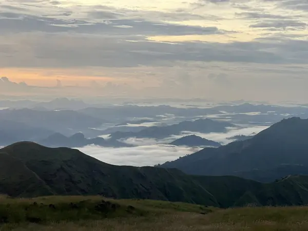
Photo: Khow Puttaraksa · All rights reserved. Do not use without permission.
Difficulty: Easy
Duration2–3 days (1–2 nights)
Budget per person$60–150
ElevationAbout 2,070 m
Best time to goCool season, roughly Nov–Feb
About this place
A sacred peak in Myanmar's Dawna Range, about 2,070 m high, with a relic pagoda on the summit visited by Burmese Buddhist pilgrims. The campground is an open grassy hilltop among boulders, windy and cold, about 8–10°C at night, with layers of mountains rolling away on both sides of the border.
Highlights
- Relic pagoda on a sacred summit
- Camping on an open grassy hilltop
- Sea of mountains on both sides of the border
Before you go
About 3–4 hours by 4WD on a very dusty dirt road. From the pagoda it's about another 1 km on foot to the campground, not steep. It's a sacred site with strict rules, e.g. no shouting, and women may only go as far as a pagoda about 30 m below the summit.
Sources
Nearby places
- Vang Vieng: Pha Ngern ViewpointLaos · 504 km away
- Phou Khao Khouay Trek: Tad Sao Wa – Phou Pha Dai – Phou Pha DangLaos · 519 km away
- Phou Khao Khouay: Tad Xay & Tad Leuk (short routes)Laos · 532 km away
- Phou Hua Lon & Phou BiaLaos · 569 km away