🇹🇭 Mae Hong Son, Thailand · Doi Lung – Doi Pa
Doi Pa Ti Do – Mue Ka Do
พะตีโด่–หมื่อก่าโด่
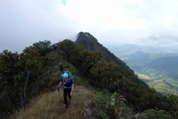
Photo: Khow Puttaraksa · All rights reserved. Do not use without permission.
Difficulty: Moderate
About this place
Two Mae Hong Son peaks known as Doi Lung and Doi Pa ("Uncle" and "Auntie" mountains), with a legend linking them. The names are as hard to say as the trail is steep — many hikers say crawling is easier than walking.
Highlights
- Two summits in one trip
- The legend of Doi Lung and Doi Pa
- Steep ridges for seasoned hikers
Day by day
- Day 1: 4 km · about 1.5 hrs on foot — Ridge camp
- Day 2: 8–9 km — Mue Ka Do (via the summit of Pa Ti Do)
- Day 3: 4 km — Ban Mae La Ka
Starts at the Ban Pang Ung checkpoint (then about 8 km by vehicle on a dirt road to the trailhead). Day 2: about 4 km up Pa Ti Do, then 4–5 km on to Mue Ka Do.
Before you go
The traverse from the summit of Pa Ti Do to Mue Ka Do is about 4–5 km, but crosses several hills. The descent passes streams and villagers' fields to the pickup point (the map position is approximate).
Do you need a guide? Book a slot with the park and ask about guides and porters when you book
Sources
Nearby places
- Khun Nam Ngao Long-Distance Trek (Mae Ngao NP)Mae Hong Son, Thailand · 17 km away
- Mon Kong Khao (Mae Ngao NP)Mae Hong Son, Thailand · 26 km away
- Phue Noe Le Su (Mae Wai Waterfall), Tha Song YangTak, Thailand · 44 km away
- Ta Do Gui & Wa Mae Khi WaterfallsTak, Thailand · 50 km away