🇹🇭 Chaiyaphum, Thailand · Phu Laen Kha National Park
Pha Hua Nak, Phu Laen Kha
ผาหัวนาค ภูแลนคา
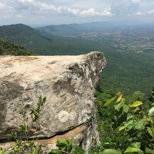
Photo: ::::=UT=:::: · CC BY-SA 3.0
Difficulty: EasyDay trip
About this place
A cliff about 450 m long overlooking a winding ridge that looks like the body of a naga serpent stretching along the Phetchabun range. The short trail starts at about 860 m with clear views of Phu Khiao, then drops onto sandstone slabs before climbing back to the top — a look at the upland forest of Isan.
Highlights
- Naga-shaped ridge
- Sandstone slabs a hundred million years old
- A 12 km long route for keen hikers
Long-distance San Phaya Nak route: 12–12.33 km, about 7 hrs, from Pha Hua Nak to the Pha Kluai Mai viewpoint (one way).
Before you go
The Pha Hua Nak nature trail is about 2.66 km return and takes 1.5–2 hours — good for families and beginners. Keener hikers can take the long-distance "San Phaya Nak" route, about 12.33 km, about 7 hours (difficulty 3 out of 5), from Pha Hua Nak to the Pha Kluai Mai viewpoint.
Do you need a guide? You can hike on your own
Contact the park
Phu Laen Kha National Park Headquarters
Sources
Nearby places
- Sai Thong Siam Tulip Fields (Thung Bua Sawan)Chaiyaphum, Thailand · 44 km away
- Pa Hin Ngam Siam Tulip FieldChaiyaphum, Thailand · 58 km away
- Phu Pha Man: Bat Cave & WaterfallsKhon Kaen, Thailand · 88 km away
- Phu Wiang Dinosaur TrailKhon Kaen, Thailand · 102 km away