🇹🇭 Mukdahan, Yasothon, Amnat Charoen, Thailand · Phu Sa Dok Bua National Park
Phu Sa Dok Bua & Phu Pha Taem
ภูสระดอกบัว และภูผาแต้ม
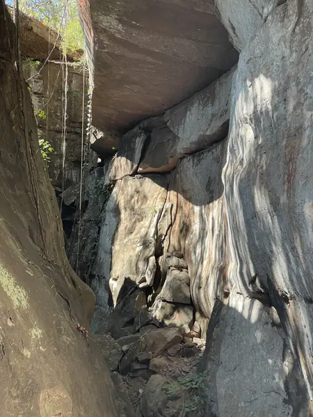
Photo: HUPKAO · All rights reserved. Do not use without permission.
Difficulty: EasyDay trip
About this place
A sandstone range in the Phu Phan mountains where three provinces meet, with broad rock plateaus that locals call "dan" alternating with stunted dipterocarp forest. Phu Pha Taem is only about 500 m away, where a cliff bears red handprint paintings about 3,000 years old. The Phu Sa Dok Bua summit has many rock pools that hold water all year with lotuses growing wild in them, which gives the mountain its name.
Highlights
- Red handprint rock paintings about 3,000 years old
- Rock pools with lotuses on the summit
- Broad rock plateaus and wildflowers at the end of the rains
Before you go
The National Park Headquarters is in Pa Rai Subdistrict, Don Tan District, Mukdahan. Phu Pha Taem is about 500 m on foot from the headquarters, while the Phu Sa Dok Bua summit takes almost a full day's walk. Ask the rangers about the route before you set off.
Do you need a guide? You can hike on your own
Contact the park
Phu Sa Dok Bua National Park
Sources
Nearby places
- Phu Pha Phueng Nature TrailKalasin, Thailand · 80 km away
- Pha Taem National ParkUbon Ratchathani, Thailand · 117 km away
- Phu Pha Yon National Park (Huai Huat)Sakon Nakhon, Thailand · 120 km away
- Pha Daeng, Phu SingKalasin, Thailand · 143 km away