🇮🇩 Indonesia
Mount Rinjani
รินจานี
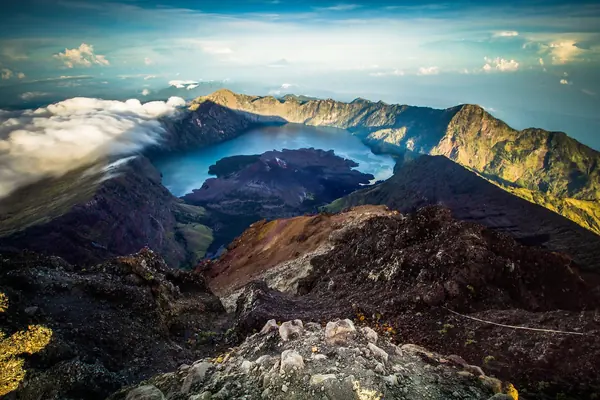
Photo: Suryasriyama · CC BY-SA 4.0
Difficulty: Hard
About this place
Indonesia's second-highest volcano, on the island of Lombok. Its crater holds the blue Segara Anak lake, with a small, still-active volcanic cone in the middle.
Highlights
- Segara Anak crater lake
- Summit at 3,726 m on loose scree
- Hot springs by the lake
Day by day
- Day 1: 9.6–10 km · about 7–9 hrs on foot — Sembalun Crater Rim
- Day 2: 13.5 km — Senaru Crater Rim (summit at dawn, down to Segara Anak lake)
- Day 3: 10.5 km · about 5 hrs on foot — Senaru village
3-day, 2-night plan, Sembalun→Senaru. Day 2 runs from 2:30 am until evening including breaks. Some plans stay overnight at the lake instead.
Before you go
Everyone entering the park needs an e-Rinjani digital ticket (QR), and foreigners must hike with a registered guide and company. Park entry for foreigners is IDR 250,000 per person per day (tier-1 routes such as Sembalun, Senaru, Torean), according to operators' websites. Additional insurance covering helicopter rescue costs IDR 290,000 (the insurance requirement starts Mar 2026). The park is open 1 Apr – 31 Dec and closed Jan–Mar; in 2026 it is closed for the full three months. There's a visitor quota, and you must carry your rubbish back down.
Sources
- greenrinjani.com
- rinjaninationalpark.com
- Wikipedia: Mount Rinjani
- Wikipedia: Visa requirements for Thai citizens
Nearby places
- Kawah IjenIndonesia · 247 km away
- Mount BromoIndonesia · 390 km away
- Gunung Mulu PinnaclesMalaysia · 1,407 km away
- Mount KinabaluMalaysia · 1,611 km away