🇯🇵 Japan
Tateyama Kurobe Alpine Route & Mt Oyama
ทาเทยามะ คุโรเบะ อัลไพน์รูท
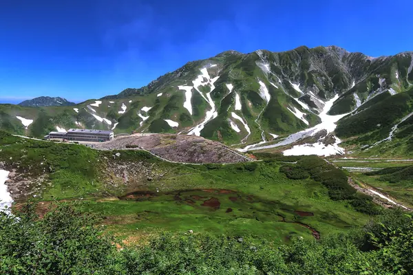
Photo: くろふね · CC BY 3.0
Difficulty: ModerateDay trip
About this place
A 37.2 km crossing of the Northern Alps by train, cable car and a series of buses. The midpoint is Murodo at 2,450 m; early in the season the road runs between snow walls about 20 m high. In summer, use Murodo as a base to walk around Mikurigaike pond and Jigokudani (Hell Valley), or to climb Mt Oyama. At the other end is Kurobe Dam, the tallest in Japan.
Highlights
- Snow walls about 20 m high at the start of the season
- Mikurigaike pond reflecting the mountains
- Kurobe Dam water discharge, late Jun–mid-Oct
The 2 hrs figure is the climb from Murodo to the Tateyama summit (3,015 m). The Alpine Route itself is by train, ropeway and bus, not a walking trail, and the websites read don't give its length.
Before you go
No permit is needed, but you buy a ticket for each transport section (train, cable car, bus, ropeway) from the Toyama side or the Nagano side; it's about 2.5 hours to Murodo. The whole route closes in winter.
Sources
Nearby places
- Happo Pond (Happo-ike), Hakuba Happo-oneJapan · 21 km away
- Northern Alps: Omote Ginza Traverse to YarigatakeJapan · 27 km away
- Mount Yari (Yarigatake)Japan · 27 km away
- Northern Alps: Panorama Ginza RouteJapan · 28 km away