🇹🇭 Nan, Thailand · Doi Phu Kha National Park
Den Chang Non
เด่นช้างนอน
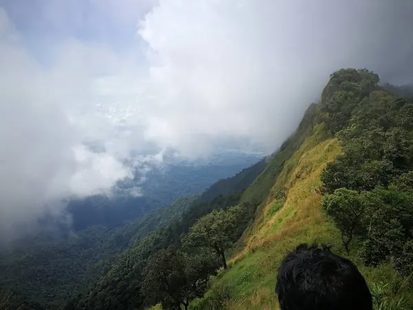
Photo: Khow Puttaraksa · All rights reserved. Do not use without permission.
Difficulty: Very hard
About this place
A ridge in the Doi Phu Kha forest with knife-edge sections dropping away on both sides. The first night is on the 1,600 m summit; on day 2 you walk along the cliffs to the 1,700 m peak, the highlight of the route, then choose between a side trip to the 1,980 m summit or heading down to camp by a stream.
Highlights
- Knife-edge ridge at the 1,700 m peak
- Side trail to Doi Phu Kha's highest summit
- Wooden bridges across cliffs
Day by day
- Day 1: 6.5 km — Ridge camp at about 1,600 m (no water source)
- Day 2: 5 km — Second camp by a stream (via the 1,700 m peak)
- Day 3: 5 km — Sila Phet Waterfall
Starts and ends at the Nam Yang weir, the entrance to Sila Phet Waterfall. The side trail up the 1,900+ m summit adds 3–4 hours.
Before you go
Start from Sila Phet Waterfall; about 18–20 km in total over 3 days, with a side trail to the 1,980 m summit (the highest point of Doi Phu Kha). A park ranger guide is required. Watch out for leeches, ticks and wooden bridges across cliffs.
Do you need a guide? A local guide or porter is required
Contact the park
Doi Phu Kha National Park Headquarters
Sources
Nearby places
- Chomphu Phu Kha Flower Trail, Doi Phu KhaNan, Thailand · 4 km away
- Phu WaeNan, Thailand · 24 km away
- Phu KheNan, Thailand · 25 km away
- Doi Suan Ya LuangNan, Phayao, Thailand · 43 km away