🇹🇭 Tak, Thailand · Ban Lisu community, Thung Kracho subdistrict
Doi Huai Thu
ดอยห้วยทู่
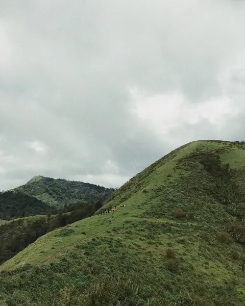
Photo: HUPKAO · All rights reserved. Do not use without permission.
Difficulty: Moderate
About this place
A new trail in Ban Tak that starts from a Lisu village, passes corn fields and banana groves, then goes up and down 2–3 hills along the ridge to camp on the crest. A comfortable distance, good for people new to trekking.
Highlights
- Ridge walk to the campsite
- Morning sea of mist and reservoir views
- Green grass in the rainy season, brown in the cool season
Day by day
- Day 1: about 3–4 hrs on foot — Overnight on Doi Huai Thu
- Day 2: about 1–3 hrs on foot — Hike back down (about 40 min – 1 hr faster than the ascent)
Hiking time = ascent time. Day 2 covers the same distance as day 1 and takes 1–2 hours less, since the descent is always faster.
Before you go
Contact the community in advance to arrange a guide and porters. It's best to go as a group of 4–5 or more. There are no toilets or water sources on the summit. Location note: the pin is at the summit campsite (about 1,350 m) per the GPS in the HUPKAO team's photos (Sep 2019), which is in Mae Ramat district near the Sam Muen subdistrict boundary, while Kapook places the Ban Lisu community in Thung Kracho subdistrict, Ban Tak district. The summit lies on the boundary of several subdistricts.
Do you need a guide? A local guide or porter is required
Sources
Nearby places
- Doi Luang TakTak, Thailand · 18 km away
- Doi MonthaTak, Thailand · 27 km away
- Doi Musoe (MUSER100 trail area), TakTak, Thailand · 32 km away
- Pha Daeng Luang (Mae Ping National Park)Lamphun, Thailand · 52 km away