🇹🇭 Tak, Thailand · Doi Soi Malai–Petrified Forest National Park (proposed)
Doi Luang Tak
ดอยหลวงตาก
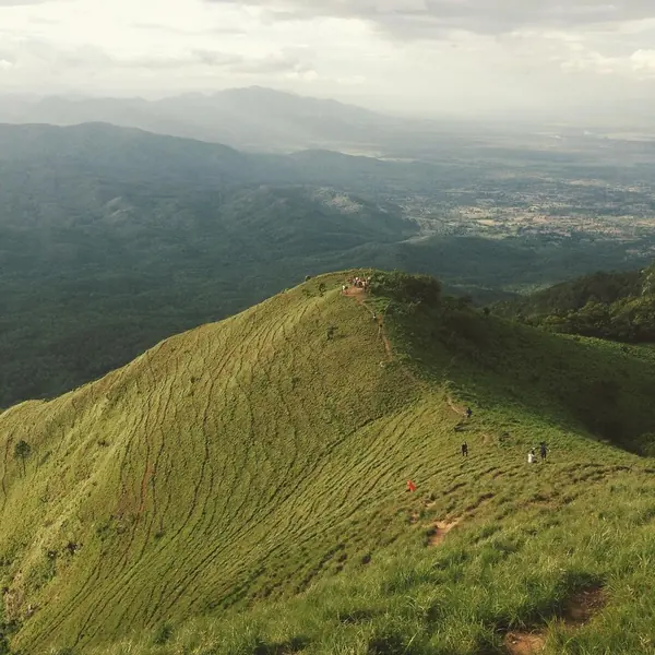
Photo: HUPKAO · All rights reserved. Do not use without permission.
Difficulty: Moderate
About this place
A summit in the Thanon Thong Chai range. The climb is about 11 km (22 km return) past streams, open forest, pine forest, grassland and rock cliffs — long but not very steep. It's known as a rainy-season trail, when the bare hills turn green all over.
Highlights
- Noen Lon Luang bare hill
- The lone pine tree
- 360-degree views of green mountains from the summit
Day by day
- Day 1: 11 km · about 5–7 hrs on foot — Campground on Doi Luang Tak
- Day 2: 11 km — Walk back down to the start (same way)
The Standard gives 11 km one way; 22 km in total according to a Lemon8 review title and adding up the daily distances. Walking time = ascent time.
Before you go
Book in advance with the park only; no walk-ins. A ranger must go with you. There are many side paths because villagers use them to forage, so don't split from the group.
Do you need a guide? A local guide or porter is required
Contact the park
Doi Soi Malai–Petrified Forest National Park
Sources
Nearby places
- Doi MonthaTak, Thailand · 13 km away
- Doi Huai ThuTak, Thailand · 18 km away
- Doi Musoe (MUSER100 trail area), TakTak, Thailand · 19 km away
- Mon Si SahaiTak, Thailand · 52 km away