🇯🇵 Japan
Kuju Mountains (Mt. Nakadake, Aso-Kuju National Park)
เทือกเขาคุจู (ยอดนากาดาเกะ)
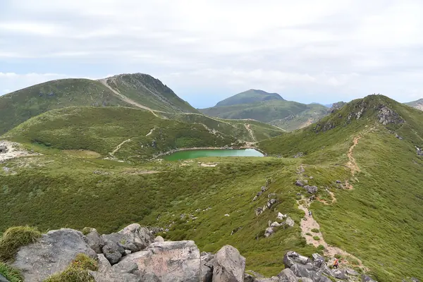
Photo: Miya.m · CC BY-SA 4.0
Difficulty: HardDay trip
About this place
The main range of Aso-Kuju National Park in Oita Prefecture, topped by Nakadake, the highest point on Kyushu. From late spring to early summer the Miyama-kirishima azaleas turn the slopes pinkish-purple, and mid Oct brings autumn colours. The walk from Makinoto Pass crosses the ridge past Miike pond to the summit, which Japanese hikers call the living room of Kyushu.
Highlights
- Nakadake, 1,791 m, the highest point on Kyushu
- Fields of Miyama-kirishima azaleas in May–Jun
- Stay at Hokkei-in Sanso hut, which has an onsen
Makinoto (1,333 m) to Kutsukake (1,503 m), via Ogi-ga-hana, Hosho and Miike pond to Nakadake, then back the same way. KYU CAMP's plan instead starts at Hokkei-in Sanso (1,303 m) and loops over Hiji-dake – Taisen, 12.2 km.
Before you go
The sources read found no permit or quota for this route. You can do it as a day hike from Makinoto Pass (1,333 m) to the summit of Nakadake (1,791 m, the highest point on Kyushu), about 11.0 km and about 5 hrs 15 min according to Japan Travel (JNTO); Hike Master Japan says about 12 km and 5–6 hrs, so they differ slightly. Or do it over 2–3 days from the Chojabaru visitor centre, via the Bogatsuru campsite or Hokkei-in Sanso hut (which has an onsen), to Taisen and Nakadake (Hike Master Japan: about 24 km). KYU CAMP's trip is 3 days, 2 nights at Hokkei-in Sanso; on day 2 it loops over Hiji-dake and Taisen, 12.2 km in about 6 hrs, with 927 m of total ascent and 1,150 m of descent. Getting there: drive and park at Makinoto Pass or the Chojabaru centre, or take a bus from Beppu, about 2 hrs and about 2,500 yen (Hike Master Japan; check the current timetable, not confirmed with the operator). Most costs have no confirmed figures from official sources; the USD budget is a rough estimate (excluding international flights). Safety: this is a ridge walk that needs reasonable fitness, with a steep first 25 minutes from the pass. Keep an eye on volcanic gas restrictions around Aso, and watch out for typhoons in Aug–Sep (Hike Master Japan). Weather on the ridge changes quickly, so carry rain gear and water.
Sources
- kyucamp.com
- Japan Travel (JNTO): Mount Nakadake Hiking Trail
- Hike Master Japan: The Kuju Mountains
- OpenStreetMap: Mount Nakadake / Makinoto Pass
Nearby places
- Yakushima: Jomon Sugi TrailJapan · 311 km away
- Jirisan Ridge TraverseSouth Korea · 409 km away
- Kumano Kodo, NakahechiJapan · 428 km away
- Jeju Olle TrailSouth Korea · 437 km away