🇹🇭 Yala, Thailand · Km 28, Ai Yoe Weng subdistrict
Gunung Silipat
ฆูนุงซีลีปัต
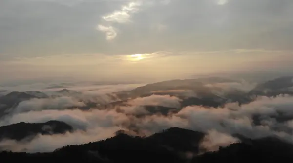
Photo: HUPKAO · All rights reserved. Do not use without permission.
Difficulty: EasyDay trip
About this place
Locals call it Gunung Sali, Malay for 'triangular rock mountain'. A small peak at the southern tip of Thailand that's a short walk, but at the top you get a panoramic sea of mist filling the border valleys.
Highlights
- 360-degree sea of mist at Thailand's southern tip
- Short trail up for sunrise
- Combine with Betong town and the Ai Yoe Weng Skywalk
Day by day
- Day 1: 2 km — Camping area below the summit (long trail)
- Day 2: No distance info — Up to the viewpoint (about 200 m), then back down
About 3 km by four-wheel-drive before walking. The short trail is about 700 m to the summit (steep; most people go up before dawn); the long trail is about 2 km, a little over an hour, for overnight stays (ascent distance).
Before you go
Take a four-wheel-drive about 3 km from the main road, then choose either the short trail of about 700 m (steep for the last 200 m) to see the sea of mist before dawn, or the long trail of about 2 km if you're staying overnight. The usual meeting point is a restaurant around km 28.
Do you need a guide? Not required, but a guide is recommended
Sources
Nearby places
- Ton Nga Chang WaterfallSongkhla, Thailand · 156 km away
- Khao Chet Yot (Banthat Range)Trang, Phatthalung, Thailand · 215 km away
- Sa Morakot (Emerald Pool)Krabi, Thailand · 308 km away
- Wang Hip (Khlong Wang Hip trek)Nakhon Si Thammarat, Thailand · 312 km away