🇲🇾 Malaysia
Gunung Tahan, Taman Negara
กุนุงตาฮัน
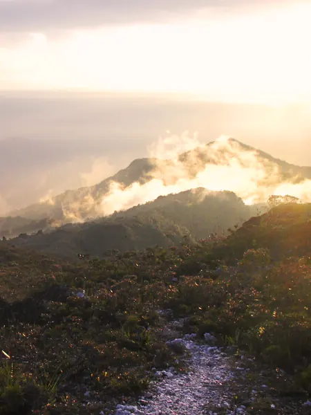
Photo: Shaiful Azman Bin Abdul Rahim · CC BY-SA 3.0
Difficulty: Very hard
About this place
The highest peak in Peninsular Malaysia, deep in the ancient Taman Negara rainforest, millions of years old. You cross rivers and dozens of ridges for almost a week before reaching the summit.
Highlights
- Highest peak in Peninsular Malaysia
- Ancient rainforest
- Countless river crossings
Day by day
- Day 1: No distance info — Kuala Melantai
- Day 2: No distance info — Kuala Puteh (Kem Putih)
- Day 3: No distance info — Kem Pangkin
- Day 4: No distance info — Kem Gedung
- Day 5: No distance info — Gunung Tahan summit, then down to Bukit Botak
- Day 6: No distance info — Kem Kor
- Day 7: No distance info — Kuala Juram (Merapoh)
The Kuala Tahan route is about 53–55 km one way to the summit. The sample 7-day programme goes up from Kuala Tahan and down to Merapoh. No daily distances found.
Before you go
A licensed guide is required — no solo hiking. You must register at the park office and attend a briefing before setting off. Permits are issued by PERHILITAN (Department of Wildlife and National Parks). Fees listed on a private website: park entry RM1, camera permit (including smartphones) RM5 per device, camping RM1 per person per night (guide and porter fees are separate and not confirmed). The Kuala Tahan route takes at least 7 days return, the Merapoh route at least 5 days, and the traverse about 7 days. The trail closes every year 15 Nov – 15 Jan for the monsoon; best Mar–Oct. You cross rivers many times, there are leeches and there is no mobile signal.
Sources
Nearby places
- Cameron Highlands TrailsMalaysia · 96 km away
- Bolaven PlateauLaos · 1,253 km away
- Mulayit TaungMyanmar · 1,362 km away
- Gunung Mulu PinnaclesMalaysia · 1,406 km away