🇹🇭 Mae Hong Son, Thailand · Ban Huai Hi community / Doi Pui Luang
Wa Wa Jo – Hong Kai Ridge – Doi Pui Luang
หว่าวาโจ หงอนไก่ ปุยหลวง
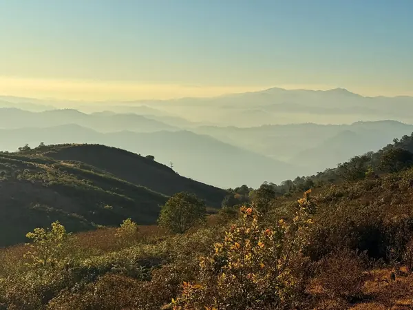
Photo: Khow Puttaraksa · All rights reserved. Do not use without permission.
Difficulty: Moderate
About this place
Three days from the Wa Wa Jo camp across the Hong Kai ridge to Doi Pui Luang, one of the highest mountains in Mae Hong Son. Sleep in a tent on the ridge with a sea of mist and cool air. This route must be done with a group led by a local guide.
Highlights
- Walking the Hong Kai ridge
- Doi Pui Luang summit, about 1,722 m
- 2 nights camping on the ridge in cool 10–15 degree air
Day by day
- Day 1: 2.5 km — Wa Wa Jo camp
- Day 2: 7 km — Doi Pui Luang (via the Hong Kai ridge)
- Day 3: 2 km — Down to the pickup point
Before you go
A 3-day, 2-night ridge hike in Mae Hong Son, passing Wa Wa Jo and Hong Kai to Doi Pui Luang. You must go with a local guide and camp for 2 nights. There are no toilets up top and water only at Doi Pui. Typical programme: day 1 is a steep climb of about 2.5 km to the Wa Wa Jo camp (about 4–5 hrs, after about 1.5 hrs by truck to the trailhead); day 2 follows the Hong Kai ridge for about 7 km to Doi Pui (about 4 hrs); day 3 descends about 2 km (about 2 hrs). Prices and conditions depend on the organiser and don't include personal porters or tent rental; organisers often require a minimum of several people. Organisers run trips Jun–Dec. Nights on the mountain are about 10–15 degrees, so bring warm clothes. Guides may change the programme for weather and safety. Route-finding along the ridge is tricky when mist comes down; stay with your guide.
Do you need a guide? A local guide or porter is required
Sources
Nearby places
- Doi Ko Mu Le (Kumole)Mae Hong Son, Thailand · 66 km away
- Pha Ngaem (Pha Song Rue Du / Two Seasons Cliff)Chiang Mai, Thailand · 80 km away
- Ang Ka Nature TrailChiang Mai, Thailand · 81 km away
- Kew Mae Pan Nature TrailChiang Mai, Thailand · 84 km away