🇯🇵 Japan
Mount Yakedake (Yake-dake), Northern Alps
ยาเกะดาเกะ (ภูเขาไฟยาเกะ)
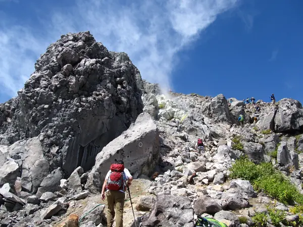
Photo: Hikomi Moneru · CC BY 3.0
Difficulty: ModerateDay trip
About this place
The only steaming volcano in the Northern Alps, right next to the Kamikochi valley. The summit is a reddish-brown crater rim with a small crater lake, looking out over the Hotaka peaks and Kamikochi from above. Climb from the Kamikochi side with its thrilling steep ladder, or take the shorter, easier Shin-Nakanoyu side.
Highlights
- Active volcanic crater and crater lake
- Views of Hotaka and the Kamikochi valley from the top
- A steep ladder of about 80 degrees, about 10 m long, on the Kamikochi side
Shin-Nakanoyu side: about 6.3–6.4 km return, about 808–860 m of climbing, about 4 hrs 20 min – 5 hrs. Kamikochi side: about 12–13 km return, about 980–1,080 m of climbing, about 7 hrs 30 min.
Before you go
No permit and no entry fee, but Yakedake is the only active volcano in the Northern Alps, so always check the Japan Meteorological Agency (JMA) volcanic alert level before you go. From 25 Jan to 4 Mar 2026 it was raised to level 2, restricting access near the crater, and it returned to level 1 from 4 Mar 2026. JMA still warns that the volcano is likely to become more active in the medium to long term; wear a helmet and don't rest in the steaming areas. There are 2 main approaches. (1) Kamikochi side: start from Kamikochi, which private cars can't enter, so you take a bus. About 4 hrs 20 min up and about 3 hrs 10 min down. The hard part is a steep aluminium ladder at about 80 degrees, about 10 m long, followed by a rock face with chains to hold; if you're afraid of heights, choose the other side. On the way you pass Yakedake Hut (Shin-Nakao Pass, 2,100 m, sleeps 20, open about early Jun – mid Oct, 8,000 yen with 2 meals or 5,500 yen without). In winter, from about early–mid Nov to mid May, the trail from Kamikochi to the hut is closed and the bridge is removed; the ladder is taken down after about mid Oct. (2) Shin-Nakanoyu side: shorter and easier, with no steep ladder. It starts at a trailhead at 1,655 m with parking for about 20 cars. About 2 hrs 20 min up and about 2 hrs down. If you take the bus to the Nakanoyu stop, you have to walk about 3 km more along the road (50–70 min). Don't confuse it with the old Nakanoyu trail, which is closed because the path collapsed. The upper section is rock and volcanic sand and is slippery. There is no water or shop on the Shin-Nakanoyu side, so carry enough water. Transport: Hirayu – Kamikochi return 2,800 yen; Matsumoto – Shin-Shimashima (train) 710 yen, then a bus to Kamikochi for 3,100 yen one way. Kamikochi's 2026 season runs 17 Apr – 15 Nov. The budget on the site is an approximate dollar figure based on transport and hut costs.
Sources
- db.go-nagano.net
- japanesealps.net
- japanesealps.net
- weathernews.jp
- weathernews.jp
- watabi.org
- emgoto.com
- Wikipedia: Visa policy of Japan
Nearby places
- Kamikochi ValleyJapan · 5 km away
- Karasawa Cirque & Mt OkuhotakaJapan · 9 km away
- Mount Yari (Yarigatake)Japan · 14 km away
- Northern Alps: Omote Ginza Traverse to YarigatakeJapan · 14 km away