🇫🇷 France
GR20, Corsica
จีอาร์ 20 คอร์ซิกา
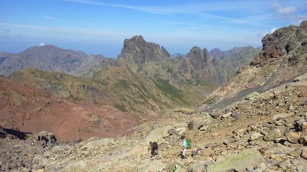
Photo: Borvan53 · CC BY-SA 4.0
Difficulty: Very hard
About this place
Known as the toughest long-distance trail in Europe, crossing Corsica along granite ridges, with sections where you scramble with your hands and hold on to chains. For people who already have multi-day hiking experience.
Highlights
- Rock scrambles and chains
- Mountain lakes and meadows with wild horses
- Views of the Mediterranean on both sides
Day by day
- Day 1: 10.9 km · about 4.5–7.4 hrs on foot — Refuge Ortu di u Piobbu
- Day 2: 7.3 km · about 2.75–4.5 hrs on foot — Refuge Carrozzu
- Day 3: 4.9 km · about 2.5–4 hrs on foot — Ascu Stagnu (Haut Asco)
- Day 4: 8.3 km · about 4–6.4 hrs on foot — Refuge Tighjettu
- Day 5: 6.4 km · about 2.5–4 hrs on foot — Refuge Ciottulu di i Mori
- Day 6: 24.8 km · about 6.2–10 hrs on foot — Refuge Manganu
- Day 7: 8.5 km · about 3.25–5.2 hrs on foot — Refuge Petra Piana
- Day 8: 9.8 km · about 3–4.7 hrs on foot — Bergerie de l'Onda
- Day 9: 10.2 km · about 3.4–5.6 hrs on foot — Vizzavona
- Day 10: 13.8 km · about 4.3–7 hrs on foot — E Capannelle
- Day 11: 17.6 km · about 5–8 hrs on foot — Refuge de Prati
- Day 12: 10.9 km · about 3.4–5.5 hrs on foot — Refuge d'Usciolu
- Day 13: 10.9 km · about 2.7–4.3 hrs on foot — A Matalza
- Day 14: 9.9 km · about 3.1–5 hrs on foot — Refuge d'Asinau
- Day 15: 15.2 km · about 3.9–6.4 hrs on foot — Refuge I Paliri
- Day 16: 13.1 km · about 3.25–5.25 hrs on foot — Conca
Split into 16 stages by hut (north→south); many people combine some stages to finish in 13-15 days.
Before you go
No hiking permit is needed, but since 2023 every night must be booked in advance online at pnr-resa.corsica — refuge beds, bivouac spots and rented tents alike. Camping along the trail outside designated areas is not allowed. The Corsica Regional Nature Park (PNRC) refuges are open for the 2026 season from 16 May to 4 Oct. Prices published by the PNRC: bed €20, bivouac spot €12, 1-person rented tent €27; food averages €50 a day. You may not leave Calenzana after 11:00 because of the wildfire risk. Emergency number 112.
Sources
Nearby places
- Tour du Mont BlancFrance, Italy, Switzerland · 446 km away
- Oeschinensee Panorama Hike, KanderstegSwitzerland · 495 km away
- Alta Via 1, DolomitesItaly · 559 km away
- Heilbronner Weg (Allgäu Alps, Oberstdorf)Germany · 579 km away