🇹🇭 Sukhothai, Thailand · Ramkhamhaeng National Park
Khao Luang, Sukhothai
เขาหลวง สุโขทัย
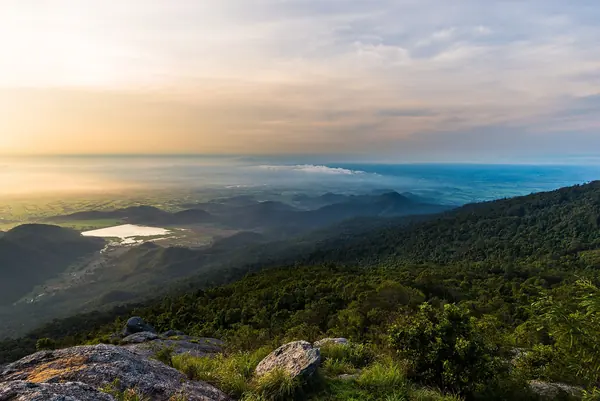
Photo: Yothind · CC BY-SA 4.0
Difficulty: Moderate
About this place
A mountain near old Sukhothai. The trail is only about 3.7 km but steep, taking 3–5 hours to reach the summit, with views over the Sukhothai plain from the top.
Highlights
- Close to Sukhothai Historical Park
- Short but steep
- Views over the plain from the summit
Day by day
- Day 1: 3.7 km · about 3–5 hrs on foot — Summit campsite
- Day 2: 3.7 km · about 1–4 hrs on foot — Back down to the trailhead
Climb up on day 1 and come down on day 2 by the same steep route. Day 2 covers the same distance as day 1 and takes 1–2 hours less, since the descent is always faster.
Before you go
You can hike up on your own without a ranger guide (according to reviews). The trail is about 3.7 km and climbs continuously with almost no flat sections; some sources describe gradients of 45–90 degrees. The ascent takes about 3.5–7 hrs (one review: 3 hrs 20 min up, 2 hrs down). Park entry: adults 40 THB, children 20 THB, cars 30 THB; foreign visitors pay a higher rate. Camping fee 30 THB per person per night, tent rental 225 THB per tent, sleeping bag 50 THB, porters 25 THB per kg (charged both up and down). On the summit there is a welfare shop, hot water in the morning and evening, and separate men's and women's toilets. Mobile signal comes and goes. Sources disagree on the hours when you may start climbing — both 07:00–14:00 and 08:00–15:30 are given — so check with the park first.
Do you need a guide? You can hike on your own
Contact the park
Ramkhamhaeng National Park Headquarters
Sources
Nearby places
- Doi Luang TakTak, Thailand · 79 km away
- Doi MonthaTak, Thailand · 83 km away
- Doi Musoe (MUSER100 trail area), TakTak, Thailand · 85 km away
- Doi Huai ThuTak, Thailand · 93 km away