🇮🇸 Iceland
Laugavegur Trail
เลากาเวกูร์
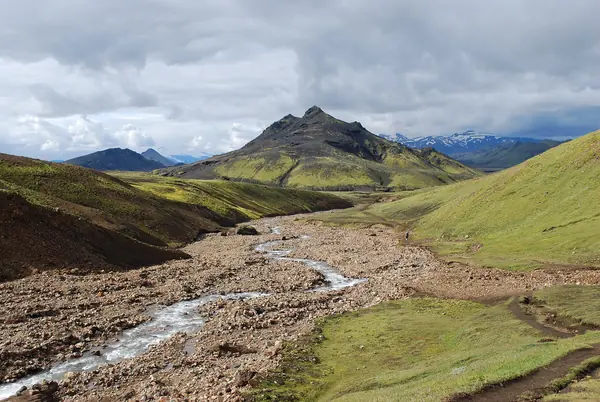
Photo: Chmee2/Valtameri · CC BY 3.0
Difficulty: Moderate
Duration4 days, 3 nights
Total distance54–56 km · One way
Budget per person$800–1,500
ElevationAbout 1,050 m
Best time to goLate Jun – mid-Sep
About this place
A walk across Iceland's volcanic highlands, from multicoloured rhyolite mountains, hot springs and obsidian fields down to the green valley of Þórsmörk.
Highlights
- Multicoloured mountains at Landmannalaugar
- A soak in natural hot springs before setting off
- Fording glacial streams
Day by day
- Day 1: 12 km · about 4–5 hrs on foot — Hrafntinnusker
- Day 2: 12 km · about 4–5 hrs on foot — Álftavatn
- Day 3: 16–17 km · about 6–7 hrs on foot — Emstrur (Botnar)
- Day 4: 15 km · about 6–7 hrs on foot — Þórsmörk
Before you go
The trail is about 54 km from Landmannalaugar to Þórsmörk, with three main huts: Hrafntinnusker, Álftavatn and Emstrur. You must ford at least three rivers. In the early sections visibility can be poor in fog or snow. The trail is open from around late Jun to mid-Sep. No official information was found confirming hut booking rules and prices, so check with Ferðafélag Íslands before planning.
Sources
Nearby places
- Norway Three Cliffs: Trolltunga, Preikestolen & KjeragNorway · 1,400 km away
- Lofoten & Senja Summer Hiking, NorwayNorway · 1,500 km away
- Oeschinensee Panorama Hike, KanderstegSwitzerland · 2,543 km away
- Heilbronner Weg (Allgäu Alps, Oberstdorf)Germany · 2,572 km away